Mapping benthic habitat
This effort aims to validate our methods for creating a map of shallow seafloor benthic habitat types, testing out techniques at Surfside Beach, covering the bay from Rooi Manonchi to the end of the airport. From shore, this map will also extend outwards to the edge of the reef shelf on the outer side of the reef islands. We’re taking two approaches for these maps. One using underwater imagery, and one using satellite imagery.
Quick links
- Kayak mapping protocol and video instructions
- Data portal for map downloads
- Image geotagging instructions
- Image upload for classification
- Google Earth Engine seafloor mapping script
- Zooniverse image classification
- Validation report
- Final presentation of results
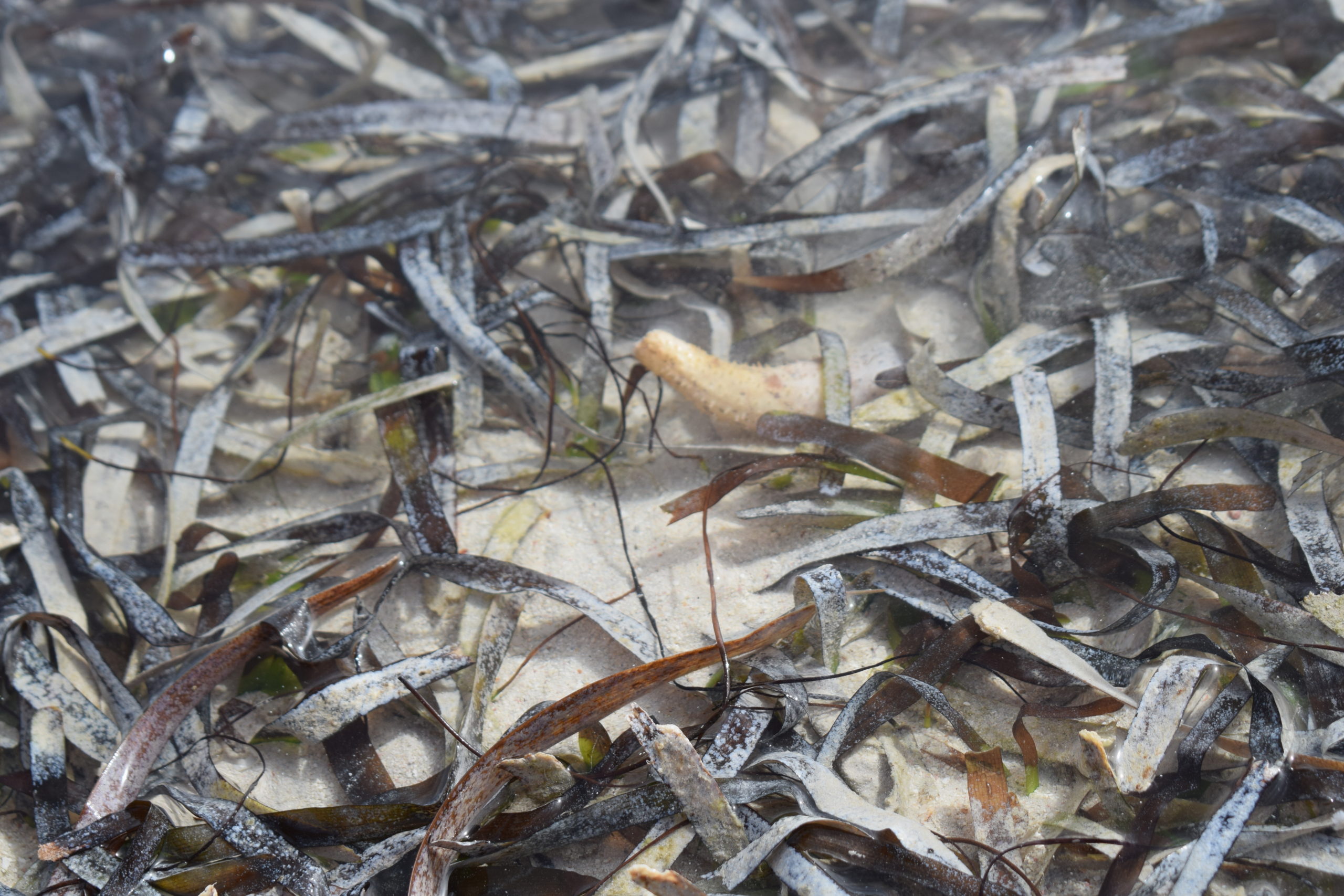
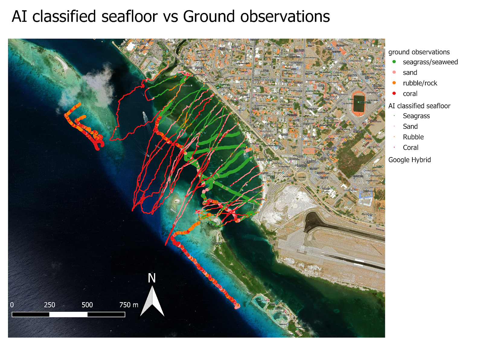
To collect a lot of underwater images we have had help from volunteer citizen scientists, mostly paddling Kayaks, but they could also paddle board, windsurf, drive boats, dive, or snorkel. We strap a GoPro underneath the Kayak pointing down in timelapse mode, and track the GPS location using a cell phone up top. After, the locations are synced and added to the photos, and they are uploaded to the cloud for our AI to classify. Once classified, these can be downloaded as a table of locations and habitat types, which can be visualized directly or used to produce more complete maps. Here’s what the points look like:

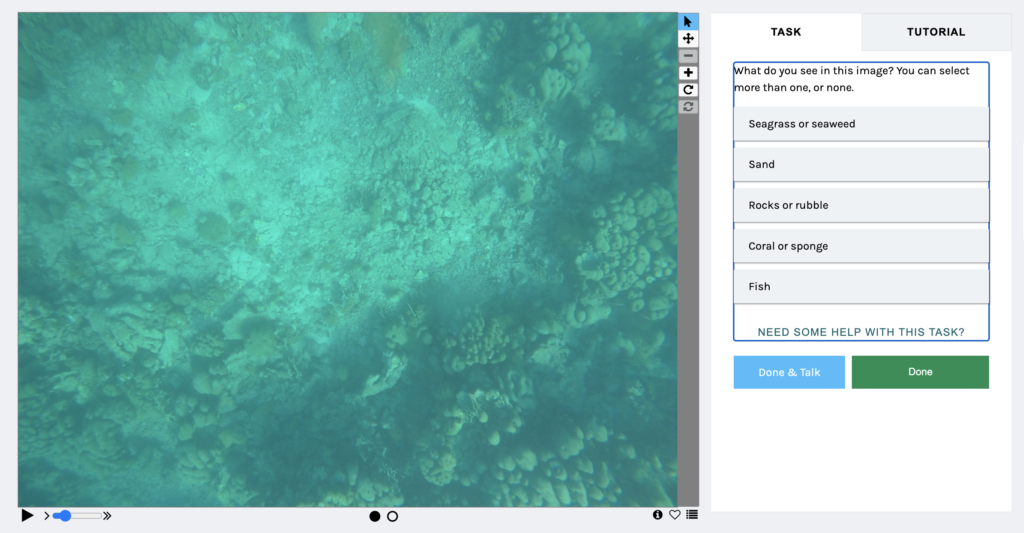
We also use citizen scientists to help us train the AI, through a platform called Zooniverse. This website lets us upload a set of images and lets people identify what they see, and give the images labels. Once we have enough images with labels for each habitat type, including seagrass, sand, rocks, and coral, we use them to train the AI so that it can learn to classify other images.
https://www.zooniverse.org/projects/brenchies/aruba-seafloor-mapping
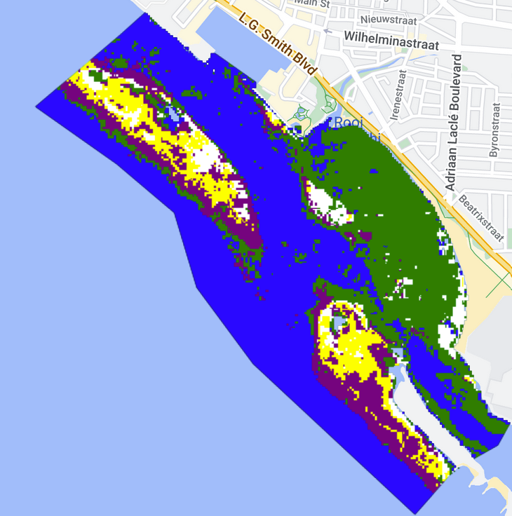
For the satellite mapping approach, we also use an AI machine learning algorithm, set up through the Google Earth Engine platform. We give it some training data, let it know which habitats are in which areas based on observations we made in the field, and then we run satellite imagery through it to let it use that training to fill in the rest of the map.
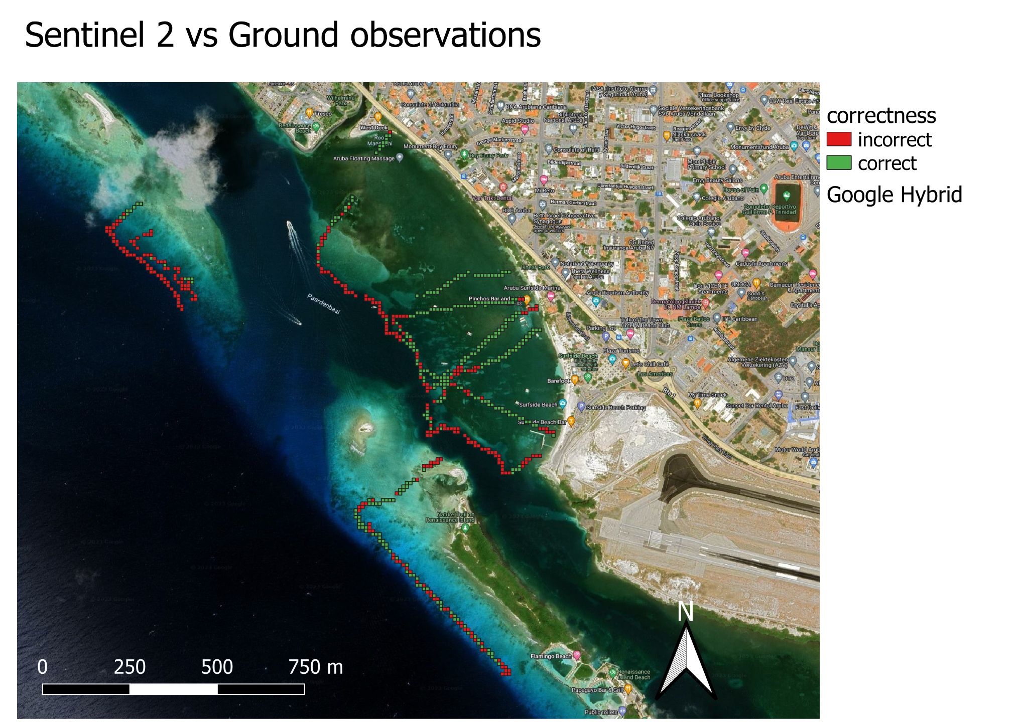
In order to test these methods, our validation coordinator guided a diving team from ScubbleBubbles to collect images of the seafloor along transects, which were classified by a marine biologist and compared to our maps.
The results of the validation showed that the satellite based maps were about 60% accurate, and the maps based on kayak imagery were less accurate, about 20%. Part of the reason for this is that the kayak based map follows the line of the kayak, which had very few overlaps with the validation images collected by divers. The satellite based maps on the other hand were able to fill in the entire area, so the classifications could be compared for every point in the validation data.
[remaining text translated from Papiamento by ChatGPT]
Why measure vegetation in the water?
71% of the world is covered by water. This covers a total of 362 million km2 of the world, but only a small fraction has been mapped for direct observation. We have less knowledge of the ocean compared to how much we know about the landscape of Mars. However, this information is crucial for our well-being. By measuring the changes in vegetation and coral in the ocean, we can see how it affects life in the ocean and along the coast.
SEAGRASS
Seagrass absorbs a large amount of carbon dioxide from the water like how trees absorb it from the air, which helps to slow down the process of climate change. It has even been suggested that seagrass meadows can absorb carbon dioxide 40 times more efficiently than rainforests on land. This makes seagrass a significant contributor in reducing carbon dioxide in the water and helps to maintain a healthy pH level.
Seagrass also forms a habitat and a food source for more than 1,000 species of fish and seafood, such as crabs, baby fish, shellfish, urchins, turtles, and fish that are caught and eaten by humans. Seagrass creates its own food through photosynthesis and is essential in the food web.
Seagrass provides support for our reefs and protects our coast from bad weather and rising tides because their roots hold onto the ocean floor like an anchor, which consumes the energy from the waves that hit the coast. Seagrass also keeps the water clean by absorbing nutrients and bacteria.
CORAL
Coral covers only 1% of the ocean floor worldwide, but it supports 25% of all marine species in the world. It has been estimated that there are around 2 million species living in coral reefs, with even more species yet to be discovered, making it the ecosystem with the most diversity in the world. Coral reefs also absorb 97% of the wave energy, which is a significant help in preventing waves from hitting the coast during storms.
Coral is a living animal, and the reef is a structure formed by the accumulation of coral, which grows together and can extend up to 100 km in length. It takes a long time for the coral to grow, with the fastest growing coral only growing 15 cm per year, and as it grows, it grows slower. Coral has been found to have lived for more than 4,000 years, and you can tell its age by counting the rings in its structure, similar to how you can tell the age of a tree. This shows how much time it takes for coral to become large and form a coral reef.