
The aim of this work is to use satellite data to analyze how white sand beach areas of the island of Aruba are changing over time. Aruba is strongly dependent on tourism, which relies on our beaches, so monitoring of our beaches is of core importance to the Aruban economy. The beaches are also directly related to reef health, and are affected by the adjacent coastal landscape, beach grass and other coastal plants that help maintain beach structure, as well as coral reef ecosystems that support the process of new sand production.
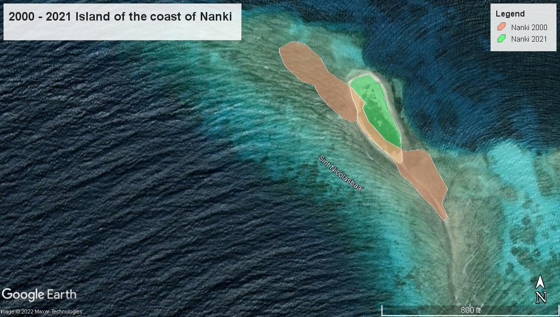
The simplest approach uses satellite imagery and a manual technique to map beaches, tracing over them by drawing polygons. Using Google Earth Pro desktop software, you can work with historical satellite imagery from their collection. This imagery is very high resolution, much higher than other globally accessible data sets, and the manual technique is straightforward and approachable to get you started with mapping.
Guia: Mapeo di Beachnan i Rif
Guide: Mapping Beaches and Reef Islands
Video: Mapping Beaches with Google Earth Pro
Notes: Open GIS Sessions