COASTLINE VALIDATION

Fieldwork has started for the validation of our coastline and reef island mapping efforts. The protocols are evolving as we gain more experience, and soon we’ll be able to compare our satellite based maps to see how accurate they are.
The coastline changes naturally, but also from human influence such as deforestation, over-development and climate change. Globally, many beaches are literally losing ground to such effects. Erosion of shorelines due to storms, waves, and sea level rise are leading to displacement of communities and terrestrial and shallow marine habitat.
To track such changes over time and space, we make use of satellite imagery and automated analysis methods using Geographic Information Systems (GIS). These methods are based on shorelines being interpreted as the boundary separating water and non-water pixels. Satellite imagery is becoming increasingly more accessible to the public with platforms such as Google Earth Engine and Microsoft Planetary Computer.
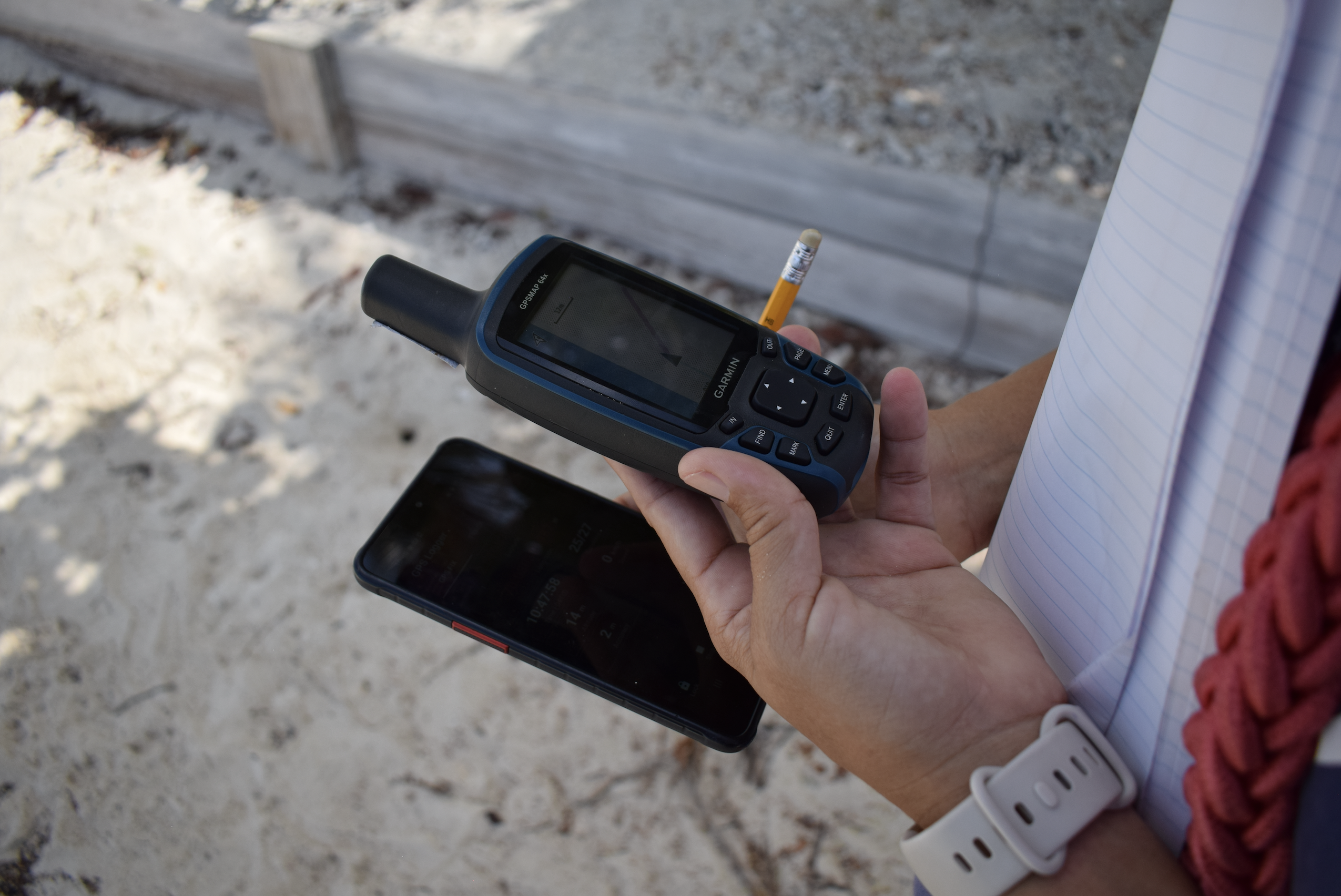
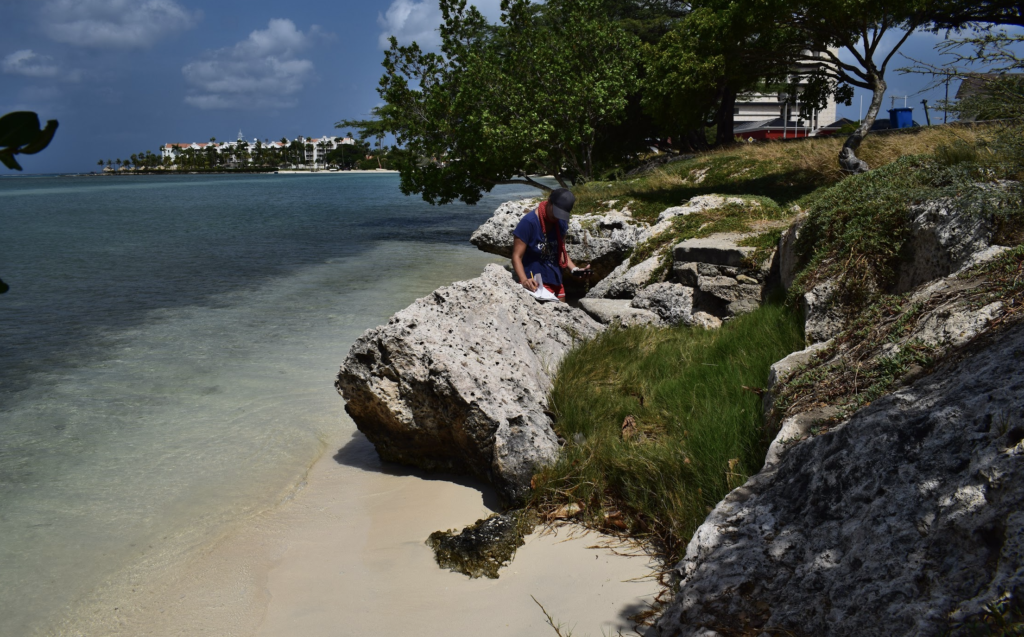
The spatial resolution of satellite imagery is one of our main challenges, so our validation efforts are critical to know how accurate our maps are at the scale of the reef islands and beaches at Surfside. This process aligns our analysis using Google Earth Engine with a physical walk on the beach on the same date and time the satellite passes over it, tracking the coastline with with a handheld GPS device. This technique is called ground truthing, basically checking how “true” our maps are to observations on the ground.


We do this with two devices set up for GPS tracking:
- A survey-grade Garmin GPS receiver (borrowed from the University of Aruba, thanks guys!)
- A consumer-grade GPS receiver, i.e. an Android mobile phone
This way we can also compare the accuracy of the GPS on a phone — which is a potentially cost-effective validation method — relative to a dedicated GPS navigation device. While ground observation is a labor-intensive technique for measuring coastal changes over time, it works for validating satellite imagery at small spatial scales, such as our pilot site Surfside Beach.

It has been quite the adventure to trace the coastline, climbing over fofoti trees, passing the tracker over suntanning tourists and ducking politely under fishing poles. All in the interest of good science, as we have to map between wet and dry sand, there is no option to go around. So far we have collected a total of 8 tracks at different hours and tides. Each track is aligned as closely as possible between the timing of the satellite, and the neap tides, when the tide changes least during the half moon periods. Next we’ll check satellite images for cloud free options to complete the validation.
VOLUNTEER POWER!
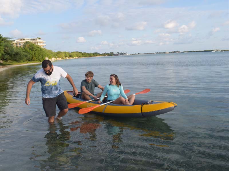
On March 11th we held a volunteer day where we had hourly slots for 3 people to kayak out to the outer reef edge and back. We had previously tried different methods, and found that working with a grid system, as you can see on the first image, is a bit difficult to figure out the boundaries of areas further away from landmarks. This meant mostly areas near the coast got mapped over the course of 5 kayak sessions with volunteers.

So this time we came up with the strategy of straight out and straight back which gave great results. With this method we were able to map a larger area in a single day. This also meant that we could get a snapshot of the bay at a single time point. Over the course of the day, we managed to map all you can see here:
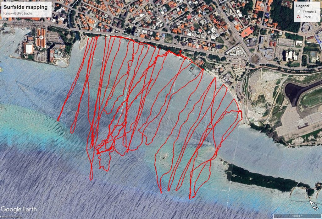
Which helped fill in the gaps in our overall coverage:

Check out what the volunteers have to say in this video
These images and tracks are now in the process of being sorted, uploaded, geotagged and classified by our newly trained AI, which will then be used to put together our first map of the area using the technique. Yes, that’s right version 1 of our AI is running, and currently being tested! Stay tuned!
LOCAL2030 NETWORK
During the first week of April, we had the pleasure to represent Aruba in the Local 2030 Islands Network Community of Practice on climate data, in Hawai’i!
We met people from islands around the Caribbean, the Pacific, Africa, and Indian Ocean, and made friends with many of them. We talked story with Hawaiians and learned about the differences and similarities between our islands, separated by 16 hours in a plane.
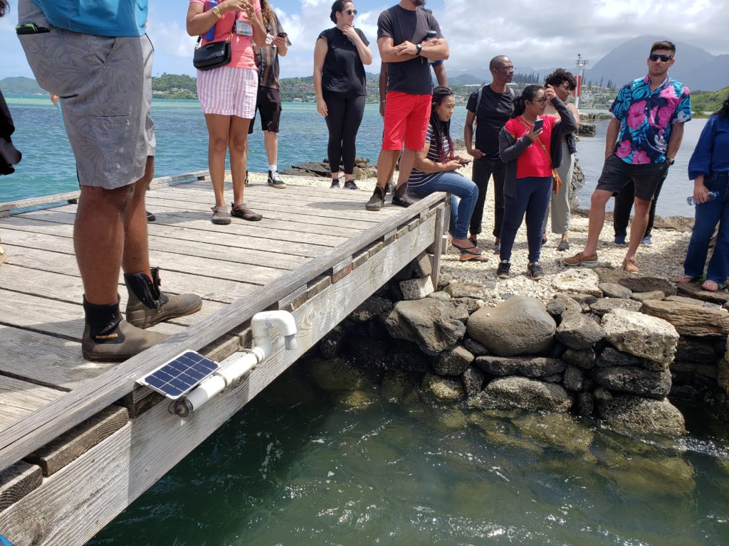
As Hawai’i is so far away from the contiguous United States, many national datasets don’t include the islands. At the same time, they have developed institutional capacity with funding and collaborations to develop some extremely detailed maps of coastal ecosystems, including species level mapping of coral responses to warming events and automated underwater imagery processing for reef analysis. We were also introduced to Hohonu, a global sea level monitoring system using arduino-based devices linked to a dashboard, Backyard Buoys, a program to link coastal communities into global ocean information systems with monitoring buoys, and an open data platform for the state of Hawai’i.
We also shared and learned from other islanders, getting tips about satellite image processing from the Northern Mariana Islands, discussing ideas around small-scale plastic recycling in Rapa Nui, and hearing experiences and struggles around climate data collection and sustainable tourism efforts in Palau, Galapagos, Cook Islands, Guam, Seychelles, Cabo Verde, Guinea-Bissau, Puerto Rico, Curaçao, and others. In total more than 60 islands were represented at the conference, and it was an honor to be present on Aruba’s behalf along with Tyson Lopez of FPNA.
Of course, not intending to spend the entire trip in a windowless nondescript conference room, we spent the last days exploring the island of O’ahu, climbing craters, hiking ridges, walking beaches, and observing the similarities and differences in the flora and fauna, including beautiful red mangroves which are apparently invasive and disliked in Hawai’i.
With all this shared, we must say that we still can’t justify emitting so much carbon flying a quarter of the way around the world. And we are not sure how to continue collaborating and building deep relationships without causing this type of harm to the planet. But with that reflection on the struggle of Mālama, we have to say a big Mahalo and Aloha to Hawai’i.
NATIONAL FLAG AND ANTHEM DAY
18 March is Aruba’s National Flag and Anthem day which is always filled with many cultural activities all over the island, and what better way to show love for your country and people than by sharing our work and appreciation for our coastal ecosystem! We were at Cas di Cultura with all our infographics printed out in poster size and our seafloor mapping kayak setup on display. Many subscribed to our newsletter, so to you we say welcome, and thanks for your interest in the project!