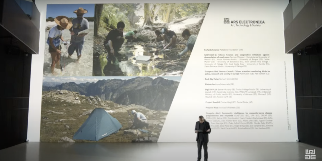
EU Citizen Science Prize Honorary Mention
This year, for the first time, the European Union is awarding a prize to outstanding citizen science projects that promote collaborative, sustainable and fair shaping of the future. We applied, and our project was given an honorary mention! If you want to see the announcement and hear more about other interesting citizen science projects around the EU, you can watch the full press conference here.
This honorary mention also came with an invitation to present at the annual Ars Electronica festival in Austria. We’re inviting a few of our team members studying in Holland to take a train to Lenz to represent Surfside Science this fall!
This is a recognition of the efforts of everyone involved in this project, so many interns, volunteers, collaborators and community members coming together, so we want to say thank you!
https://ars.electronica.art/citizenscience/en/surfside-science/
Turning The Tide
On October 23rd-26th, 2023, the Second International Conference on Small Island States and Subnational Island Jurisdictions will take place at the University of Aruba. This symposium is co-hosted with the University of Prince Edward Island, Canada, and we’ll be presenting some of our research.
This transdisciplinary conference sets out to explore the theme of climate change and social
change on islands through the sub-themes of food sovereignty, ocean health, diverse knowledges, health and well-being, material culture, climate and social justice, contextualising in context, changing livelihoods, gender and intergenerational framing, and environmental law and governance.
Three proposals from the Surfside Science team have been accepted to participate in the conference, including Christie our project leader, Tatiana our validation coordinator, Tony our research coordinator, and Suyin our media coordinator and illustrator/storyteller. We are thankful and proud to share this journey with a team including three Aruban women working on different aspects of this project.
The power of Interns
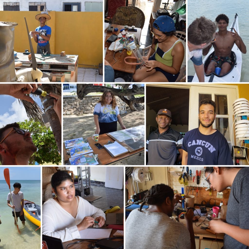
Speaking of being proud, this past year has brought us so many young spirits, brightening up our work space and powering our research efforts, and we can’t thank them enough. To our awesome interns and student volunteers, we say dankiiiii for taking on the frustrations and triumphs that come from diving into new territories. We’re so proud to see you taking on new challenges and expanding your toolboxes in the interest of ocean science. Thank you!
Working on the air quality monitoring station, building on the design of Sean Brokke were Ian Canninga from EPI, Stephen Richards, Jean-Marc Rosenstand and Timothy Romain from the University of Aruba, and Shemi Fitz Verploeg and Anthony Jones from EPB.
On mapping efforts, we had invaluable contributions from Raydeline Wever and Max van Schie from the University of Aruba Intern, and Elise Eijs from Wageningen University, collaborating online from Amsterdam. To hear a bit more detail about his experiences, you can check out this interview with Max in English.
Amaryllis Lee came all the way from Hogeschool Utrecht, where she is studying applied artificial intelligence, to work on our seafloor mapping AI together with our software engineer Jeremy Granadillo. You can check out our interview with her in Papiamento here.
On water quality stations, one of our first interns Alexandra Ulacio worked with Manuel Rojas to research and design solar-powered buoys. She explains her experience in an interview here, also in Papiamento. Timothy, Stephen, Jean-Marc, Shemi, and Anthony also lent a hand in replicating water quality sensors, and refining the 3D models.
On validation, we had Kiran Kelly assist in our methods and analysis guided by Tatiana Becker, our marine biologist and environmental engineer.
These young folks all strengthened our small team and without them the project would have been slower, harder, and not nearly as fun. Again, thank you all for your help!

Seafloor Mapping Process
One of the areas we are working on is mapping the seafloor habitats in Surfside. When we started these efforts, we built a 3D-printed open-source underwater glider, but weren’t quite able to get it swimming on its own.
Now we’re testing methods that are more affordable and replicable; in addition to analyzing satellite imagery we’re testing a novel method with gps tracking and GoPros attached to swimmers, paddleboards, kayaks, kite surfers, and windsurfers. Kayaks have become our go-to option, with a timelapse camera strapped underneath and the GPS Logger app recording the location. You can see our tutorial of the process on our YouTube channel: Seafloor Mapping Tutorial Surfside Science
There were trials and errors, days of murky waters, failed batteries, failed settings, zig-zags, lost cameras, wet interns, but with each test we improved our methods and figured out how to collect images without getting lost at sea. We opened the effort to include anyone awesome enough to help out, and citizen scientists around the island rose to the challenge. In total we had about 30 volunteers and 12 interns mapping with us. In addition to our folding Orukayak, we had folks sharing their kayaks and paddleboards including Shanon of The Shack Aruba, Tobia de Scisciolo with his inflatable backpack kayak, Myron Saladin with his electrified kayak, Joost Saris with his rescue boat, and Diego Acevedo with his paddleboards, as well as people lending us GoPros including Francielle Lacle, Ian Canninga, and Dae Hereira. We managed to take at least 80 000 seafloor pictures, actually probably a lot more than that.
The next step is ongoing to develop and train an AI model to differentiate the elements, keeping it simple with four categories: sand, rubble, seagrass and coral. Our software guy Jeremy is building on the initial models and the inputs from our Zooniverse campaigns to process thousands of images and turn them into a map. Thanks to everyone who contributed, your collective knowledge is now part of our AI! Mwahahahaha!
With that process defined, we need to start validating, collecting field data with divers, professional GPS and underwater photography equipment. This was coordinated in collaboration with ScubbleBubbles, and with some insights from reef researcher Dr. Chris Roelfsema at the University of Queensland in Australia. We made an early meeting and he made some time for us in the late evening to align our schedules. Thanks so much Dr. Roelfsema! Check out his impressive list of research publications and projects to learn more about reef mapping:
https://researchers.uq.edu.au/researcher/765
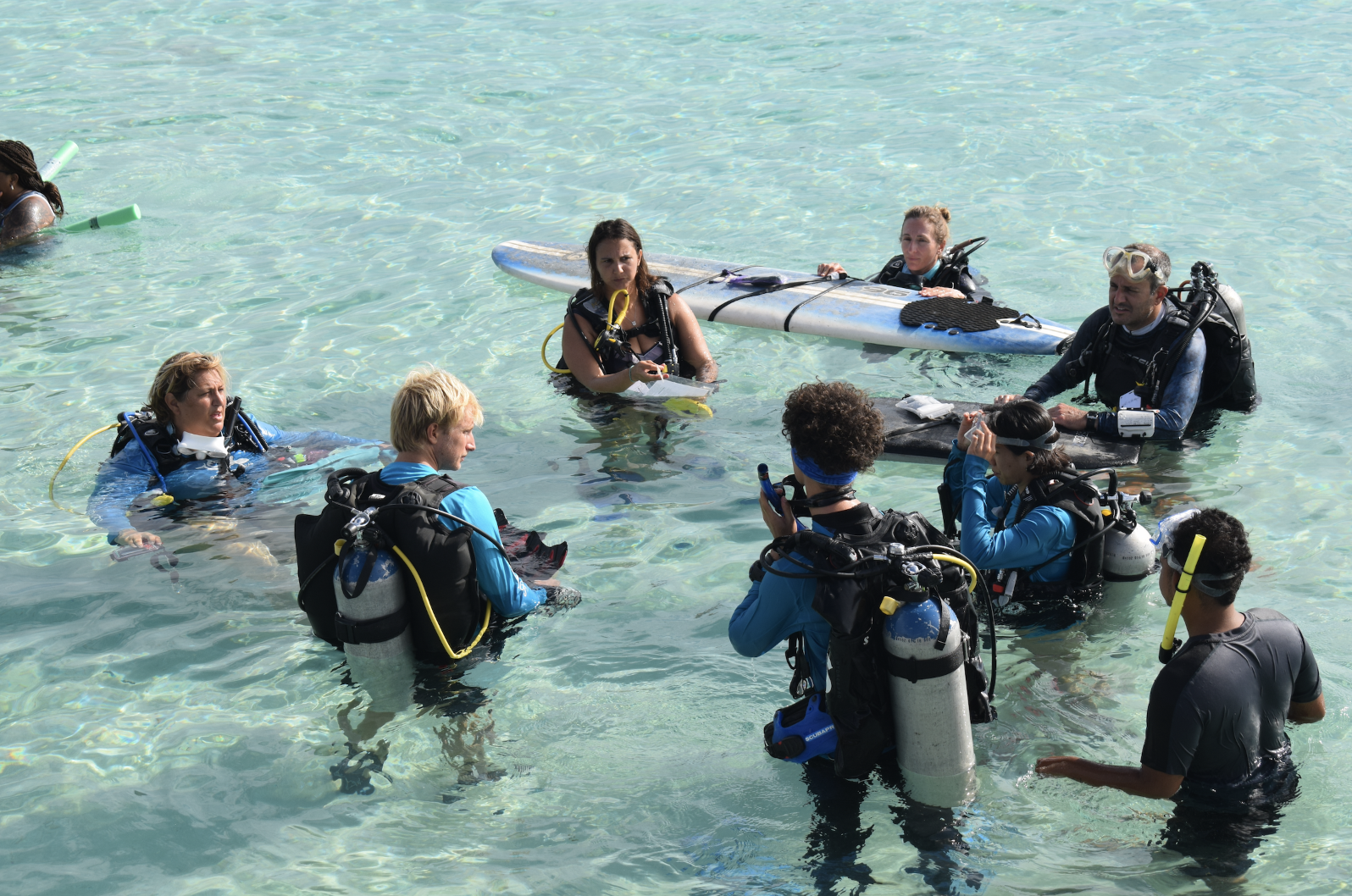
With input from Chris, Tatiana finished developing her validation methods to fit our pilot study site. Last weekend we had a team of 9 divers head to Surfside, including Tatiana, Nichole, Tobia, Adam, Arianne, Nora, Makay, Samuel and Marc. In teams of three, a snorkeler on top with floating GPS to stay exactly on top of the diver seafloor photographer, a diver assistant checking safety and tracking details, and a diver. On the Friday we briefed and tested and on Saturday and Sunday we had two teams validating. First we mapped in in front of the reef islands and then the outer banks under the supervision of Jason in his trusty boat.
To have pictures closer to the validation date we also organized another kayak mapping session, to try to cover the whole bay in a day. These pictures and coordinates are now being processed by Jeremy and Stephen, and the resulting maps will be compared with those of the validation team by Tatiana. If all goes well we will have our affordable and replicable seafloor mapping validated by next month. The dream is to have mapping sessions a few times a year to put through our pipeline and turn into maps to be shared on our website science.brenchies.com