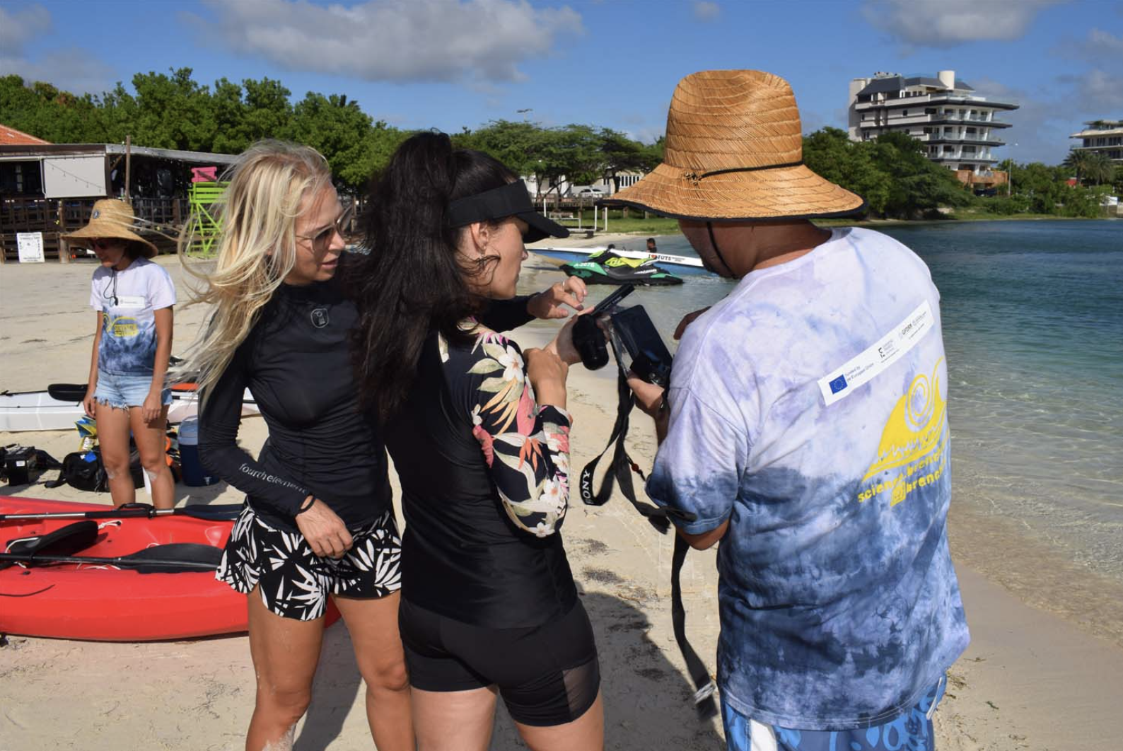
In our third month we focused on mapping. Our plan was simple: connect a GoPro underneath a kayak and track our location using a phone with GPS logger app in the kayak.
In reality there were a lot of little steps – from the app selection, to settings on different GoPros to kayaking techniques – which we had to figure out. In the midst of all these tests we also experienced frequent storms reducing underwater visibility and making it harder to go out and kayak.
And that was just the image collection side. If you want to try it out you can find our protocol here:
Sea-floor Mapping Instructions – Google Docs
Crowd-sourcing and replication
We received a lot of excited support with many kayaks being made available by Kayak Shack from Shanon as well as Tobia, Melissa, Myron, Diego and Monica. The next step was getting enough GoPros and cell phones. We used phones which we use for educational activities on Mo-B Lab and got many people to trust us with their GoPros, in particular Ian, Suyin, Dae, Tatiana and Francielle. Crowd-sourcing also allowed us to make sure the process worked with different vehicles, cameras and phones. That said we have not tested the process with an iphone yet, and when Melissa and Lisa volunteered we realized that our tracking app wasn’t available for iphones.

Hacking the meta-data
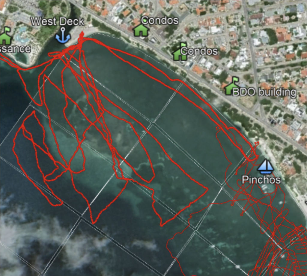
Mapping underwater is difficult because GPS doesn’t work underwater. Additionally it’s hard to measure depth in the ocean. For the purpose of our work we have not yet figured out how to measure the depth, but we are hoping to use data that has been collected by the Dutch marines: CDI – Marine data access (emodnet-bathymetry.eu). If you know someone involved with the collection of bathymetric data in Aruba and you are willing to introduce us, we would really appreciate that.
The images we have collected so far are not corrected for depth, that means that it does not represent an exact size, just a snapshot of that area from the surface. The GPS of the surface does still reflect the location of the center of each image, just not the area. This data is collected by the cell phone in the kayak using the GPS logger app. We use ExifTool to add the gps tracklog data from the phone to the metadata of the images collected by the GoPros under the kayak, which is done automatically by comparing the time. You can see how we do that here: Video to geotagged images notes – Google Docs

Zooniverse
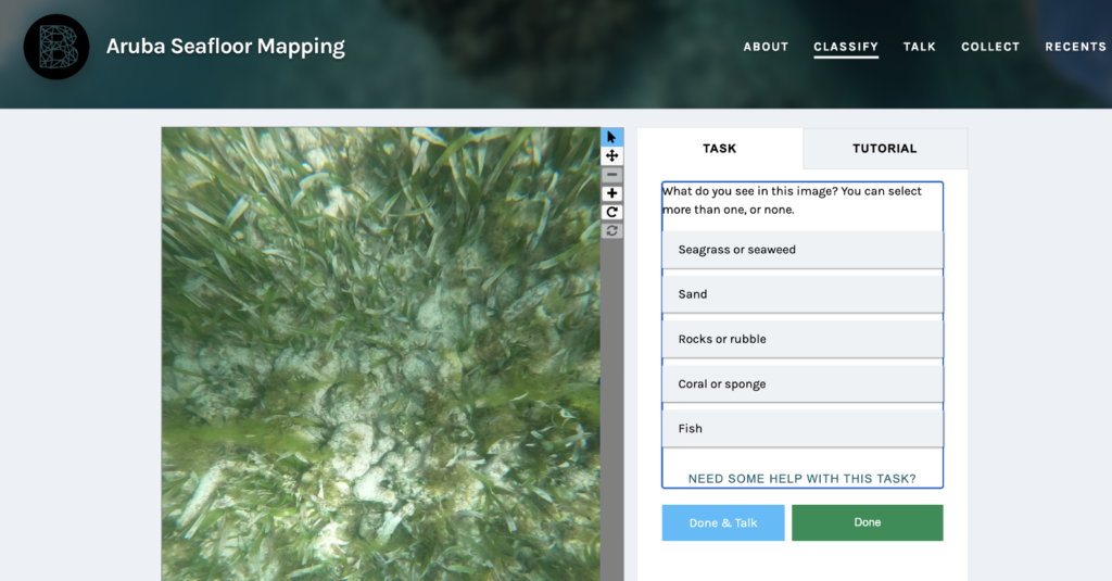
These geotagged images are currently being uploaded to our Zooniverse project: Aruba Seafloor Mapping » Classify — Zooniverse, where you can help us classify them the same way you sometimes classify images for Captcha when you complete that I am not a robot challenge. Classified images are used to train our supervised classification algorithm to recognize these different items. We realize that this is not as of yet a perfect classification but we decided to focus first on the things that are easier to differentiate and then we can further sort images. Right now the categories include seagrass/seaweed, rocks/rubble, coral/sponge, sand, and fish as a bonus.
Help us classify and share the Zooniverse link, maybe we can teach these robots a thing or two.