
Water quality sensor validation in Bonaire
A recent trip to Bonaire ended up being an important milestone for our water quality validation efforts, when we linked up with some friendly local organizations. For reasons unknown, our potential collaborating partners in Aruba withdrew their offers of support, so when we went to Bonaire we reached out to people there who were amazingly more than happy to help, even on short notice.
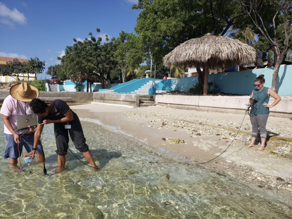
Christie and Tony had planned a personal trip to Bonaire to meet some friends and snorkel, but of course environmental science ended up joining them on the trip. Surfside Science validation coordinator Tatiana Becker got in touch with Sabine Engel from Mangrove Maniacs, who offered up her network and water quality equipment, connecting us with Roxanne Francisca of STINAPA and Jessica Johnson of Coastal Dynamics.
Their help was incredibly valuable, as they shared experiences, reference water quality equipment, and even their patient hands to hold their meter next to our DIY systems for a validation period. While many of our readings differed from the reference meter, we were able to recalibrate and confirm what the issues were and ended up with one of our DIY systems reading reasonably close, ready for the next phase of validation. The next steps are to configure a second DIY system, and to find a reference meter we can use locally for longer period, before we confirm the validity of our readings.
We appreciate Roxanne and Jessica for not only sharing equipment but stepping into the water with us to test our system. Masha danki!
Coastal mapping
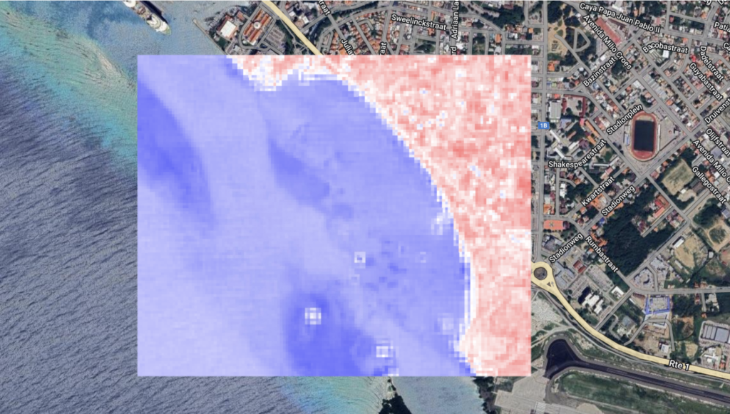
In other recent developments, we have been analyzing satellite imagery through the Google Earth Engine platform to map different elements of the Surfside coast over time.
So far we have had three interns who have worked on this GIS mapping effort. Raydeline from the University of Aruba started last summer exploring a variety of techniques and map subjects, including water and coastline, vegetation, and submerged aquatic vegetation. Max and Elise then joined in the fall. Max, from the University of Aruba, has been mapping coastal vegetation, and mangroves specifically, at Surfside and around Aruba. Elise from the University of Wageningen joined as a remote intern, also working with the Metabolic Agrifood consulting team in the Netherlands, and focused on using the mNDWI index to map the water cover and coastline of Surfside. What they mapped we can use to make a database of vegetation and mangroves coverage and changes in the coastline. Max is continuing with us to develop his scripts for automated mapping of changing coastal vegetation, and our research lead Tony is using code developed by Elise and Raydeline to do the same for the coastline and reef islands.
AI is getting closer to seafloor mapping
We had our first run at training an AI using images that were classified through Zooniverse by our online volunteers, and it went well. Right now the AI is doing pretty well at recognizing the difference between sand and seagrass in a set of test images. Some of you may remember that we’ve done this before, the difference here is that we used crowdsourced training, so it shows that our volunteer citizen scientists are doing a great job!
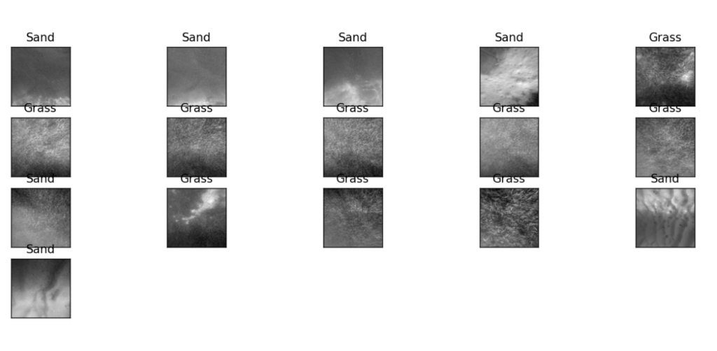
Our next step with the model will be to add other classification categories, including rocks/rubble and coral/sponge, and to collect some additional training images of cover types that are less common at Surfside, coral and sand in particular. If you’d like to help us improve our training data, head over to our Zooniverse project page to label some images.